Oceanic and Freshwater Export
Resolving the sub-mesoscale dynamics of hydrography and freshwater export from the Greenland ice-sheet using EO data and artificial intelligence.
In order to map sub-mesoscale Freshwater for hydrography we need to establish a high-resolution quasi geostrophic model for the East Greenland Sea. The output of this model will be a novel high resolution dataset of geostrophic currents and vorticities of unprecedented higher spatio-temporal resolution. The input to this model will be a combination of in-situ and satellite data. ENVEO has expanded operational ice velocity processing capabilities to include routine ice discharge calculations for key Greenland glaciers. Building on this foundtion, we plan to extend and refine the existing discharge time series while increasing the number of glaciers monitored within this fjord system.
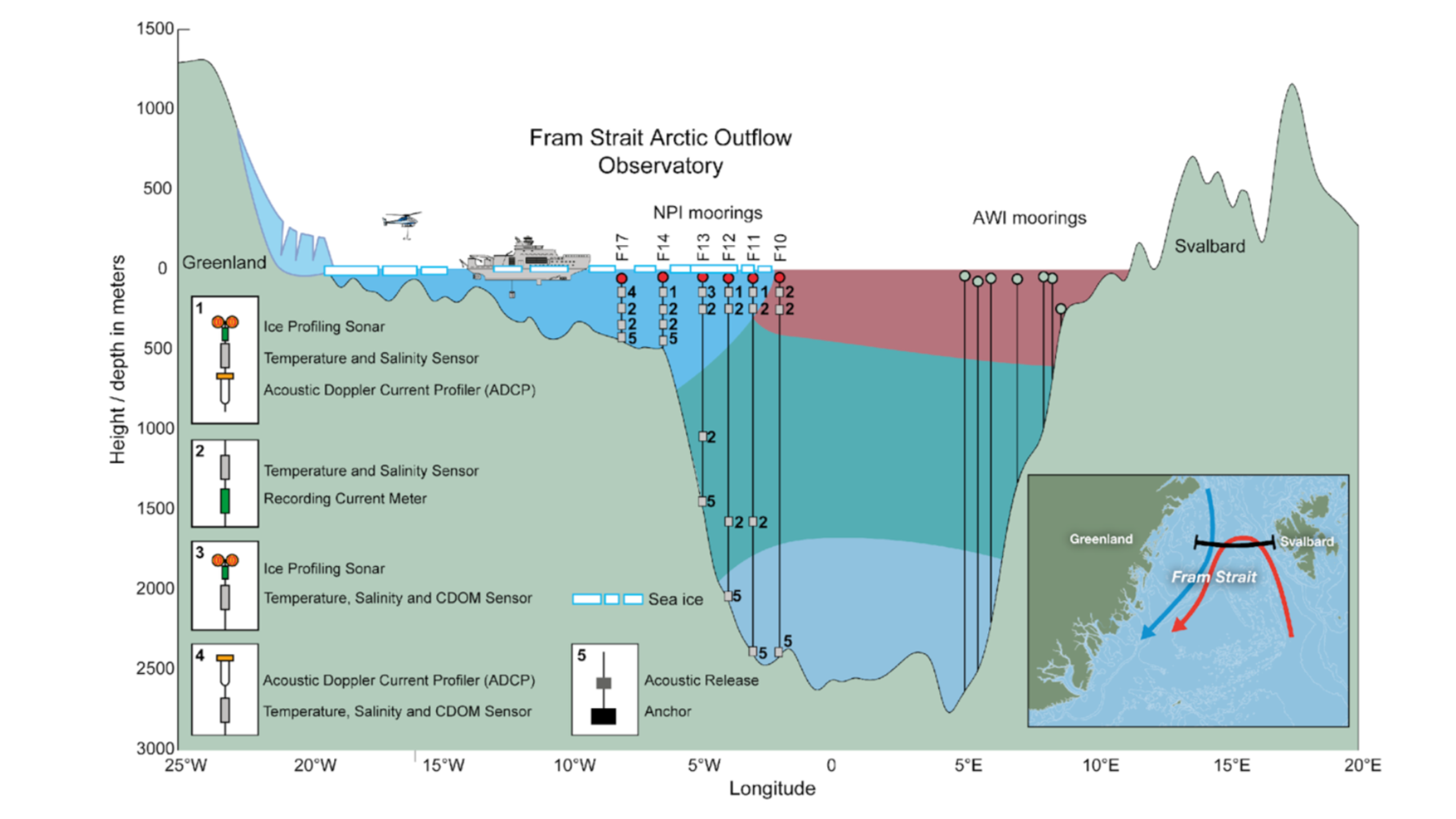
The ESA ARCFRESH project shares a boundary at the Fram Strait with the FRESH4BIO project. Freshwater through the Fram Strait provides significant freshwater contribution flowing from the north to south. Freshwater through the Fram Strait is assimilated in the regional GRL model. Fram Strait hydrographic salinity data for the model are undergoing a final quality control and will be ready in April 2025 to be integrated into the modelling with the assistance of NPI.
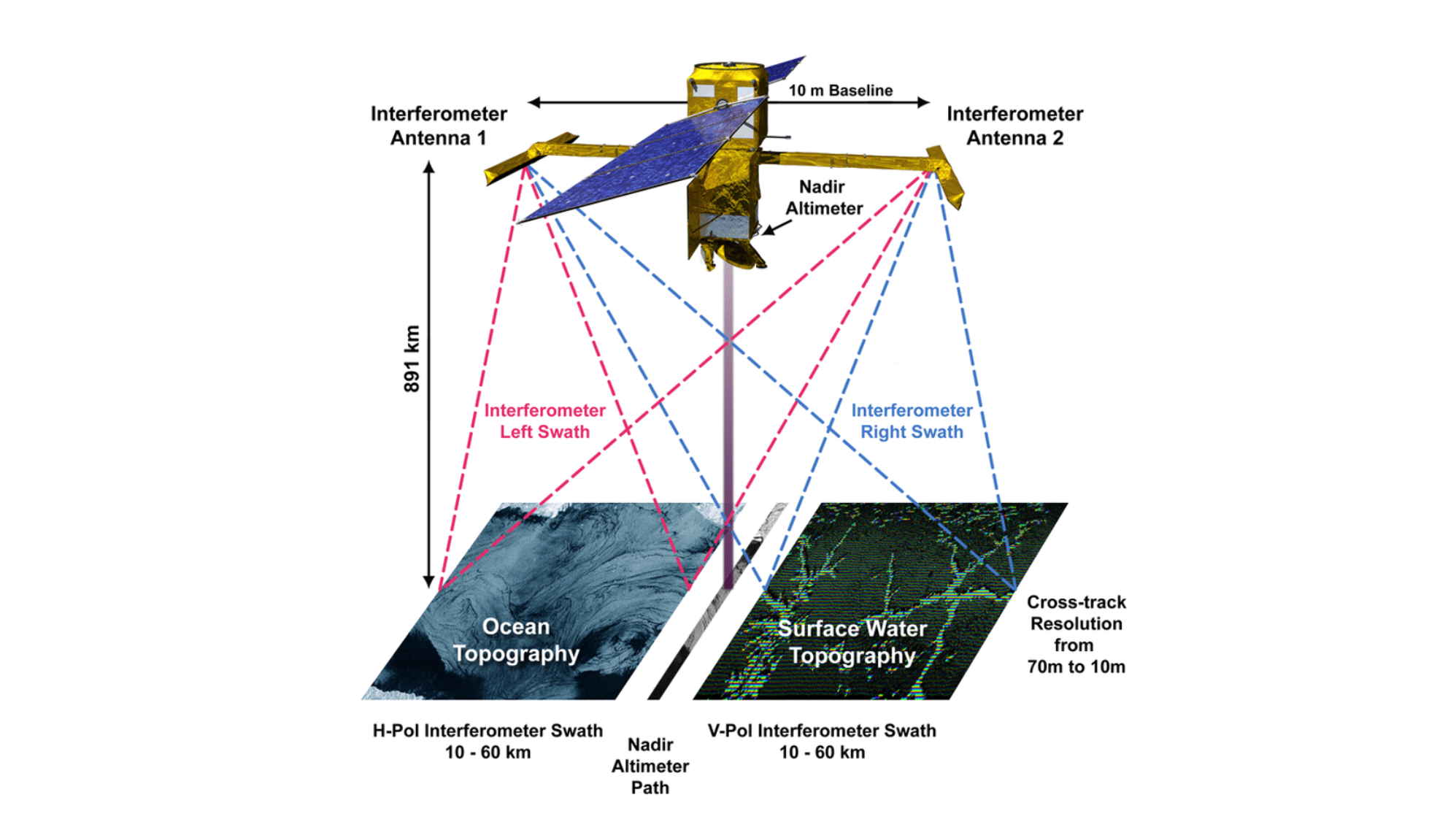
We will perform a detailed mapping of the freshwater entering the fjord of Scoresbysund from the ice-discharge, and map the sub-mesoscale freshwater distribution at the mount of the fjord in the coastal region. Because phytoplankton have an ephemeral nature with finescale features it is nearly impossible to track these with available conventional remote sensing, but interferometric altimetry capabilities of the new SWOT satellite should be able to track these due to its very high resolution in both space and time. The Fjord of Scoresbysund is located at a fast sampling SWOT track where the satellites samples twice a day with a resolution of better than 250 meter. The surface geostrophic flow can be determined from the slope of the topography measured by SWOT. Assuming that the surface geostrophic flow is a good proxy for the depth mean velocity the total water flux can be determined and by using information about the sea surface salinity the total amount of freshwater can be determined. This particularly study can quantify how interferometric altimetry capability will enhance our state of the art knowledge from satellites like S3A/B and enable our capability to map finescale ocean dynamics and phytoplankton mapping opening new possibilities to biophysical experiments in the open and coastal ocean using EO data.