Products
Explore the data products developed in the Fresh4Bio project. These datasets represent key outcomes of our work to better understand Arctic freshwater and ocean dynamics and are available for use by the wider scientific community.
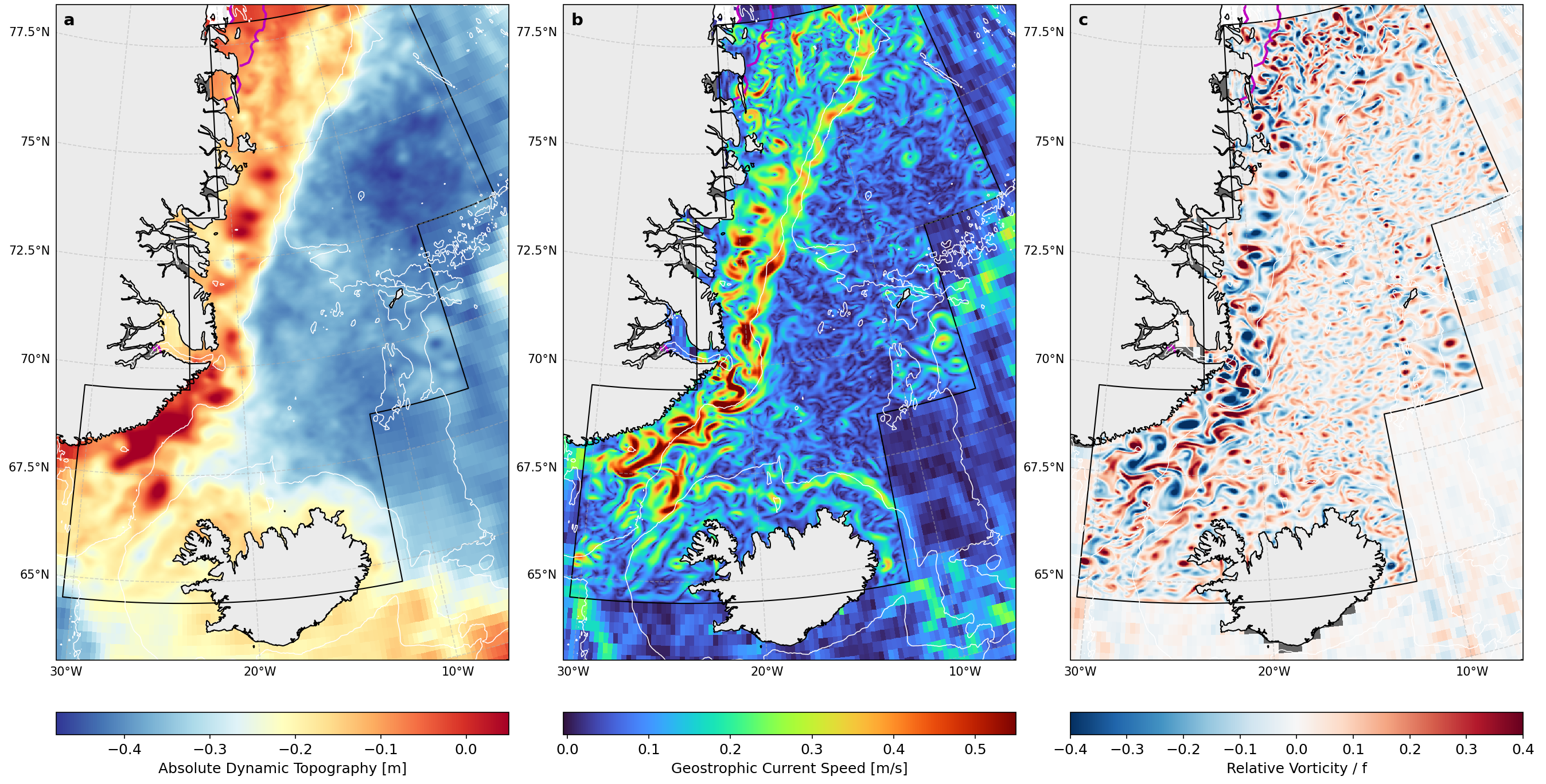
In Fresh4Bio we have produced 2 km resolution gridded maps of ocean topography (ADT), geostrophic currents, and relative vorticity from assimilation of SWOT and nadir altimetry. The products are derived by assimilating the data in a 1.5 layer quasi-geostrophic model using the BFN-QG algorithm (https://github.com/leguillf/BFN-QG). The products cover the ice-free ocean and the marginal sea ice zone (sea ice concentration 5%-75%). Areas with sea ice concentration >75% are masked out.
The dataset is available for download on data.dtu.dk
Spatial extent: 64.5°N-78°N,
30°W-1°E
Spatial resolution: 2 x 2 km
Temporal coverage: 17 June 2023 to
16 October 2024
Temporal resolution: Daily
Format: NetCDF-4
